UPDATE 11:40 a.m.
The Snaking River wildfire is now an estimated 300 hectares in size, according to BCWS.
UPDATE 10:45 a.m.
Seventy one properties are now under evacuation alert due to the Snaking River wildfire.
In a from the Cariboo Regional District Emergency Operations Centre (CRD EOC), the evacuation alert zone now includes properties along Nazko Road, Smoke Road, Bill Road, and Kishkan Road. An interactive map of the affected area can be found .
Residents under the alert need to be ready to leave at a moment's notice. This is what the CRD EOC recommends to do:
- Have a plan to transport all family members should the area be brought under evacuation order.
- Fill the gas tanks of personal vehicles.
- Keep essential items such as medications, eyeglasses, government-issued ID, valuable documents, immediate care needs for dependents or pets and, if you choose, keepsakes, readily available for a quick departure.
- Prepare to move disabled persons, children, and/or neighbours, if assistance is needed.
- Ensure that all dependents are prepared for departure.
- Prepare to move pets and livestock to a safe area.
- Arrange accommodation options for your family, if possible.
- Check with your insurer to determine what may be available to you - homeowner or tenant insurance may provide greater support than the Emergency Support Services program.
- Monitor reliable news sources for information on evacuation orders and locations of Reception Centres and the CRD鈥檚 channels on Facebook and https://www.cariboord.ca/EOCupdates/
- Self-register for Emergency Support Services on the Evacuee Registration & Assistance (ERA) tool at https://ess.gov.bc.ca/
The fire remains at 150 hectares in size.
Original
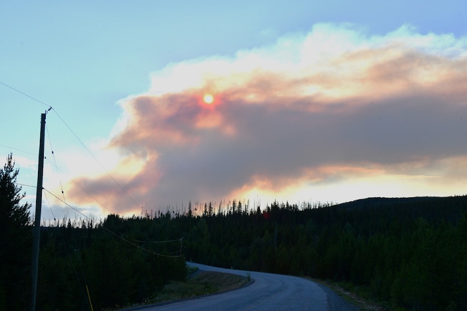
BC Wildfire Service (BCWS) crews are continuing to battle the Snaking River wildfire 65 kilometres west of Quesnel on Friday, Aug. 1.
The blaze was one of 13 lightning-caused fires to spark in the Cariboo region on Thursday, July 31. However, it quickly grew, expanding to 150 hectares by 7:30 p.m. Thursday. There is another fire in the same area, listed at 0.85 hectares in size.
Because of the growth of the fire, the Cariboo Regional District Emergency Operations Centre issued an evacuation alert for the one property in the area, located close to Harrington Road on Thursday night. The evacuation alert area covers 755 hectares and covers both fires. The map can be found .
According to BCWS, smoke from the blaze can be seen in Quesnel, Highway 97, and other surrounding communities.
As of Friday morning, BCWS has six ground personnel, multiple helicopters, and three pieces of heavy machinery attacking the blaze.
It remains 150 hectares in size and classified as out of control.
On July 30, the Cariboo Fire Centre received 1245 lightning strikes, resulting in the 13 new fires.
There are no weather warnings or alerts issued by Environment Canada at this time.


